


GOLCONDA 1 Voting District, Pope County, Illinois
About
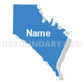
Outline

Summary
| Unique Area Identifier | 574012 |
| Name | GOLCONDA 1 Voting District |
| County | Pope County |
| State | Illinois |
| Area (square miles) | 49.18 |
| Land Area (square miles) | 47.94 |
| Water Area (square miles) | 1.24 |
| % of Land Area | 97.48 |
| % of Water Area | 2.52 |
| Latitude of the Internal Point | 37.36015900 |
| Longtitude of the Internal Point | -88.56464200 |
Maps


Graphs
Select a template below for downloading or customizing gragh for GOLCONDA 1 Voting District, Pope County, Illinois


Neighbors
Neighoring Voting District (by Name) Neighboring Voting District on the Map
- EDDYVILLE 6 Voting District, Pope County, IL
- GOLCONDA 2 Voting District, Pope County, IL
- GOLCONDA 3 Voting District, Pope County, IL
- JEFFERSON 4 Voting District, Pope County, IL
- WEBSTER 5 Voting District, Pope County, IL
Top 10 Neighboring County Subdivision (by Population) Neighboring County Subdivision on the Map
- Salem CCD, Livingston County, KY (2,974)
- Golconda No. 2 precinct, Pope County, IL (952)
- Webster No. 5 precinct, Pope County, IL (866)
- Eddyville No. 6 precinct, Pope County, IL (792)
- Golconda No. 1 precinct, Pope County, IL (707)
- Golconda No. 3 precinct, Pope County, IL (668)
- Jefferson No. 4 precinct, Pope County, IL (485)
Top 10 Neighboring Place (by Population) Neighboring Place on the Map
Top 10 Neighboring Unified School District (by Population) Neighboring Unified School District on the Map
- Livingston County School District, KY (9,519)
- Pope County Community Unit School District 1, IL (4,470)
Top 10 Neighboring State Legislative District Lower Chamber (by Population) Neighboring State Legislative District Lower Chamber on the Map
Top 10 Neighboring State Legislative District Upper Chamber (by Population) Neighboring State Legislative District Upper Chamber on the Map
Top 10 Neighboring 111th Congressional District (by Population) Neighboring 111th Congressional District on the Map
Top 10 Neighboring Census Tract (by Population) Neighboring Census Tract on the Map
- Census Tract 401, Livingston County, KY (2,974)
- Census Tract 9712, Pope County, IL (2,425)
- Census Tract 9713, Pope County, IL (2,045)